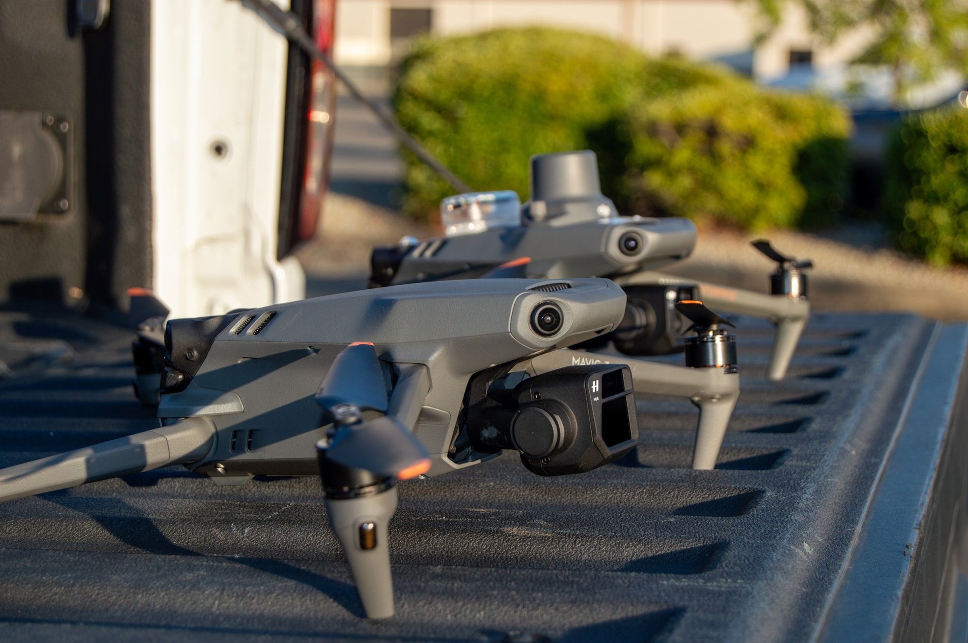
Drone
SERVICES
Ariel Photography / Videography
Real Estate
Search and Rescue
Livestock management
Surveillance
Roof Inspections
Visual Inspections
Construction Management
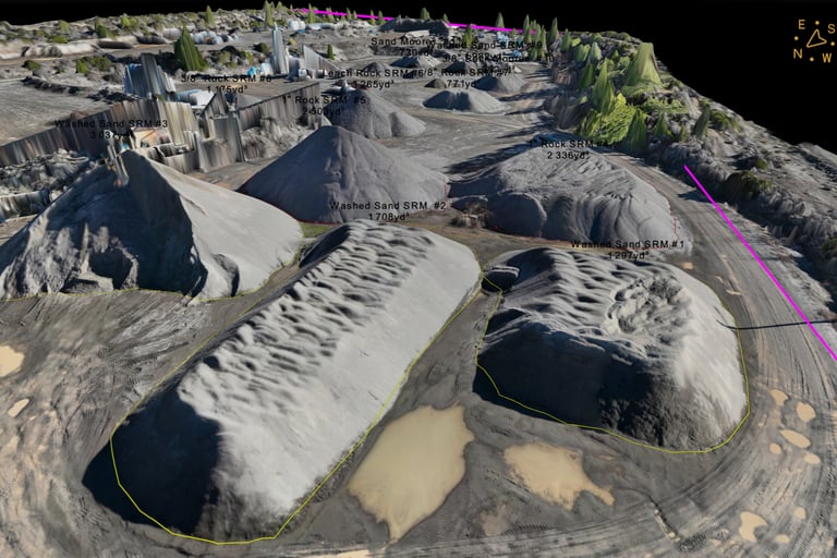
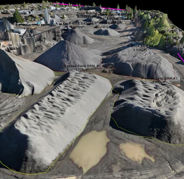
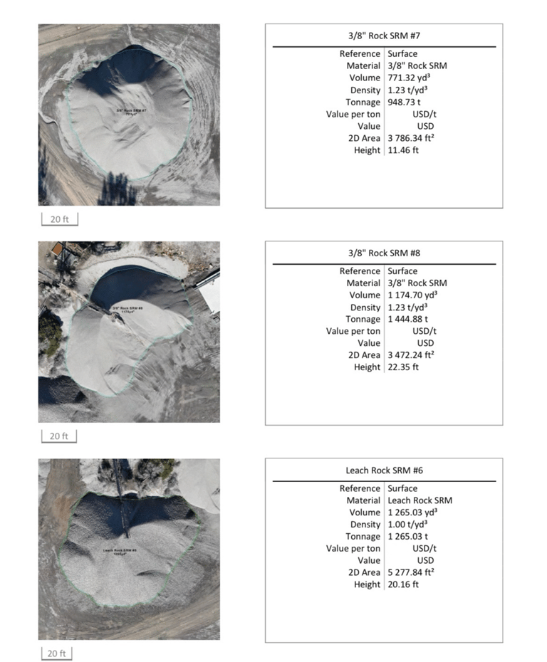
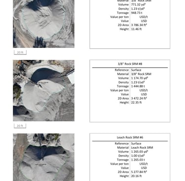
Material Stockpile Calculation
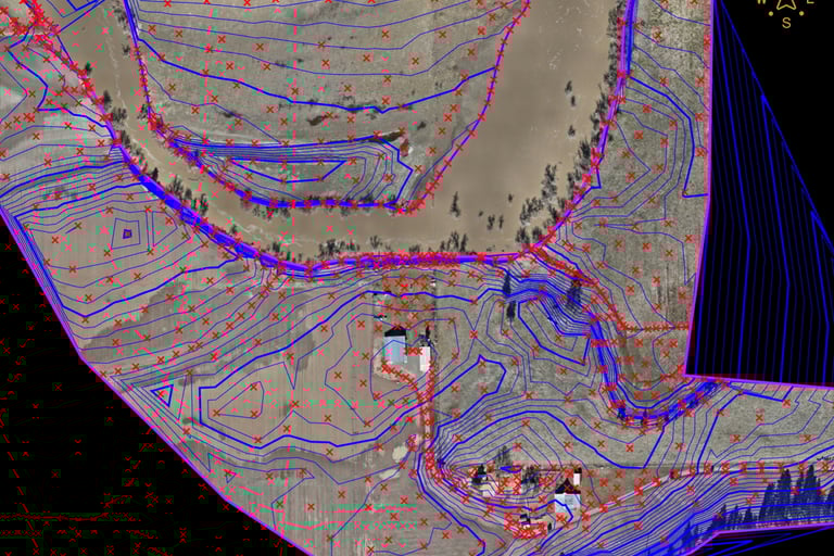
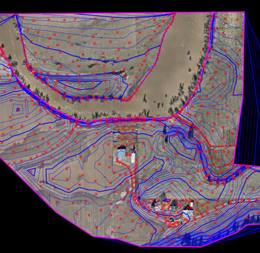
Construction Earthworks
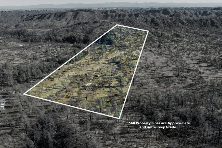
Topography Surveying
Orthomosaic Imagery
Timeline Imagery
Waste management tracking
Photography / Videography


Construction
Drones play a key role in the construction industry. From stockpile calculations to topographical surveys and project management Advanced Universal Drone Solutions does it all at the best price and quality. The difference between A.U.D.S and other drone companies is that we work with you directly and tailor our work to your specific needs. Our product is accurate because of our industry experience and cost effectiveness compared to other drone companies that just operate the drone and send out the deliverables to be processed by a 3rd party. The Software that we utilize is specifically built to bridge the gap between drone surveys and AutoCAD and similar software. Other post processing software is not as accurate and does not provide efficient data that can be correctly utilized. There is only one industry leader for post processing software and that is who we use and trust! Everything is post processed internally with A.U.D.S. We have done multiply jobs such as building topographical surveys and providing surface contours that have been utilized for project designs and 3D flood plain models. We have worked on major construction projects tracking production, resources and providing plan overlay maps of the current site. Our plan overlay maps provide a crystal-clear image compared to google earth and are extremely accurate to the referenced drawings, this helps project managers accurately plan out work and keep track of day-to-day tasks. Drones really excel when it comes to quarry management and dirt work. Tracking production on a timeline interval of your choosing showcases the always changing conditions of a quarry or jobsite. Safety, Stockpile calculations, Progression tracking, Cut/Fill Maps and more are things that can be implemented in the field from drone surveys. If you have questions about projects we have done or questions about how we can help you with your next project please call us today and let's talk about your next industrial drone solution.